

Service: Satellite Remote Sensing of Coastal and Shallow-Marine Environments: Bathymetry, Marine Habitats and Water Quality
Platforms
Digilab
Techniques
No
techniques found
Technology Readiness Level
9 - service proven in operational environment (production)
Organization
Service contact persons
Phone:302831106021
The service integrates satellite imagery to investigate coastal and shallow-marine environments, including submerged cultural heritage. It produces satellite-derived bathymetry, benthic habitat classifications and water-quality indicators, while supporting time-series, seasonal and event-based analysis. Outputs guide survey planning, environmental monitoring and assessment of coastal, seabed and anthropogenic pressures.
Integrated remote sensing service for the investigation of coastal and shallow-marine environments, including submerged cultural heritage assets. Satellite imagery is analyzed before the field deployment to define survey priorities and environmental zones.
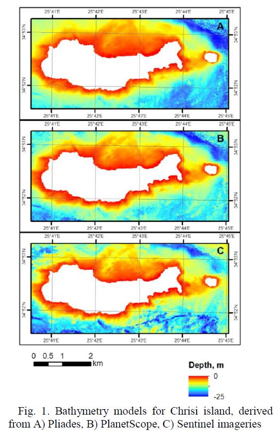
Satellite-derived bathymetry estimates water depth from wavelength-dependent light attenuation using empirical, band-ratio, semi-analytical and/or machine-learning approaches. The method is applied where water clarity, seabed visibility, image quality, depth range and reference measurements are adequate. Corrected multispectral imagery can also distinguish broad benthic and seabed-cover classes, including seagrass, macroalgae, sand, rock, mixed substrate and anthropogenic impact, subject to satellite sensor resolution and field-reference quality.
The same image processing workflow supports mapping of optically detectable water-quality indicators, including turbidity, suspended particulate matter, water clarity, chlorophyll-a, algal-bloom conditions, colored dissolved organic matter (CDOM) and water-colour indices, supporting temporal comparison.
RTK-GNSS, SonarMite depth measurements, conductivity, temperature/pH measurements, and shallow-water resistivity provide targeted field control. Earth Observation processing, bathymetric modelling, habitat and water-quality classification and uncertainty assessment are undertaken as part of the same site-specific deployment.
Fields of application
Environmental sciences
Landscape architecture (discipline)
Marine biology
Marine engineering
Underwater archaeology
Materials
Sod (soil)
Other information
-
Output: • Satellite-derived bathymetry products, depth contours and cartographic products • Accuracy, residual, uncertainty and reliable-depth-range documentation • Benthic habitat and seabed-cover classification maps • Turbidity, total suspended organic matter, chlorophyll-a, CDOM and water-colour indicator maps, subject to sensor and site suitability • Coastal-water time series, seasonal algal blooms, seagrass detection and change detection maps • Shallow-water visibility, suitability, sampling and survey-prioritization maps • Integrated land-shore-seabed assessment by linking bathymetry, coastal and marine habitats, water-quality indicators, environmental/anthropogenic pressures and cultural heritage assets