

Service: GIS-based Cultural Heritage Risk Assessment
Platforms
Digilab
Techniques
No
techniques found
Technology Readiness Level
9 - service proven in operational environment (production)
Organization
Service contact persons
Phone:302831106021
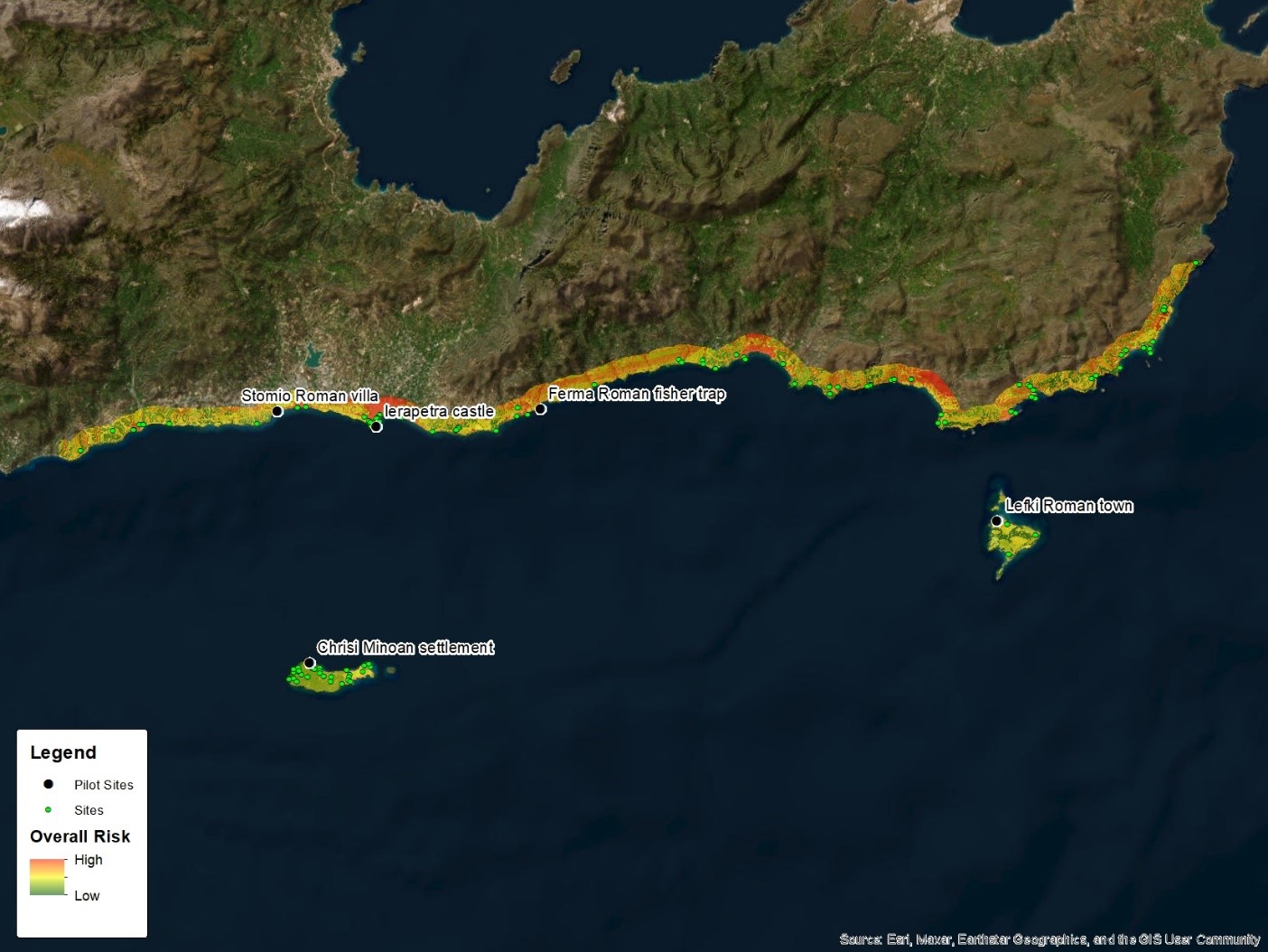
The GIS-based Cultural Heritage Risk Assessment service integrates terrain analysis, heritage inventories, Earth Observation indicators and field evidence to evaluate environmental and human-induced threats to monuments, archaeological sites and cultural landscapes. It produces hazard, exposure, vulnerability and risk maps that identify hotspots, support monitoring priorities, guide field inspections and inform targeted mitigation and conservation measures.
Integrated GIS service for assessing environmental and anthropogenic risks to cultural heritage monuments, archaeological sites and cultural landscapes. Terrain analysis, existing cultural heritage inventories and site-specific field evidence are integrated to identify where assets are exposed to natural hazards processes and to prioritize locations for inspection, monitoring and mitigation measures and conservation.
The risk assessment addresses hazards and pressures such as soil erosion, landslides, flooding, wildfire, vegetation encroachment, land-use change, agricultural activity, uncontrolled infrastructure development, drought, soil-moisture variation and ground deformation subsidence. Persistent trends from seasonal variability and event-related changes are distinguished, while terrain and hydrological modelling supports the susceptibility analysis.
Acknowledgment of Earth Observation indicators, terrain susceptibility, asset exposure and GIS-based prioritization, within a robust methodological framework. Risk outputs provide decision-support products whose reliability depends on source-data resolution, temporal coverage, field verification and the adopted weighting criteria.
Fields of application
Environmental archaeology
Heritage science (cultural heritage discipline)
Landscape archaeology
Materials
Soil
Other information
-
Output: • Change detection and disturbance maps documenting erosion, vegetation, moisture, deformation, wildfire, flooding or land-use impacts • Viewshed analysis, least-cost path, predictive archaeological and palaeolandscape models • Hazard susceptibility, asset exposure, vulnerability and multi-criteria cultural heritage risk maps • Risk hotspot and monitoring-priority maps for field inspection and mitigation measures for conservation • Site-specific geospatial risk database • Sensitivity-analysis products documenting the effect of criteria and weighting choices