

Service: Magnetic Prospection Methods
Platforms
Molab
Techniques
Fluxgate gradiometry
Technology Readiness Level
9 - service proven in operational environment (production)
Organization
Service contact persons
Phone:302831106019
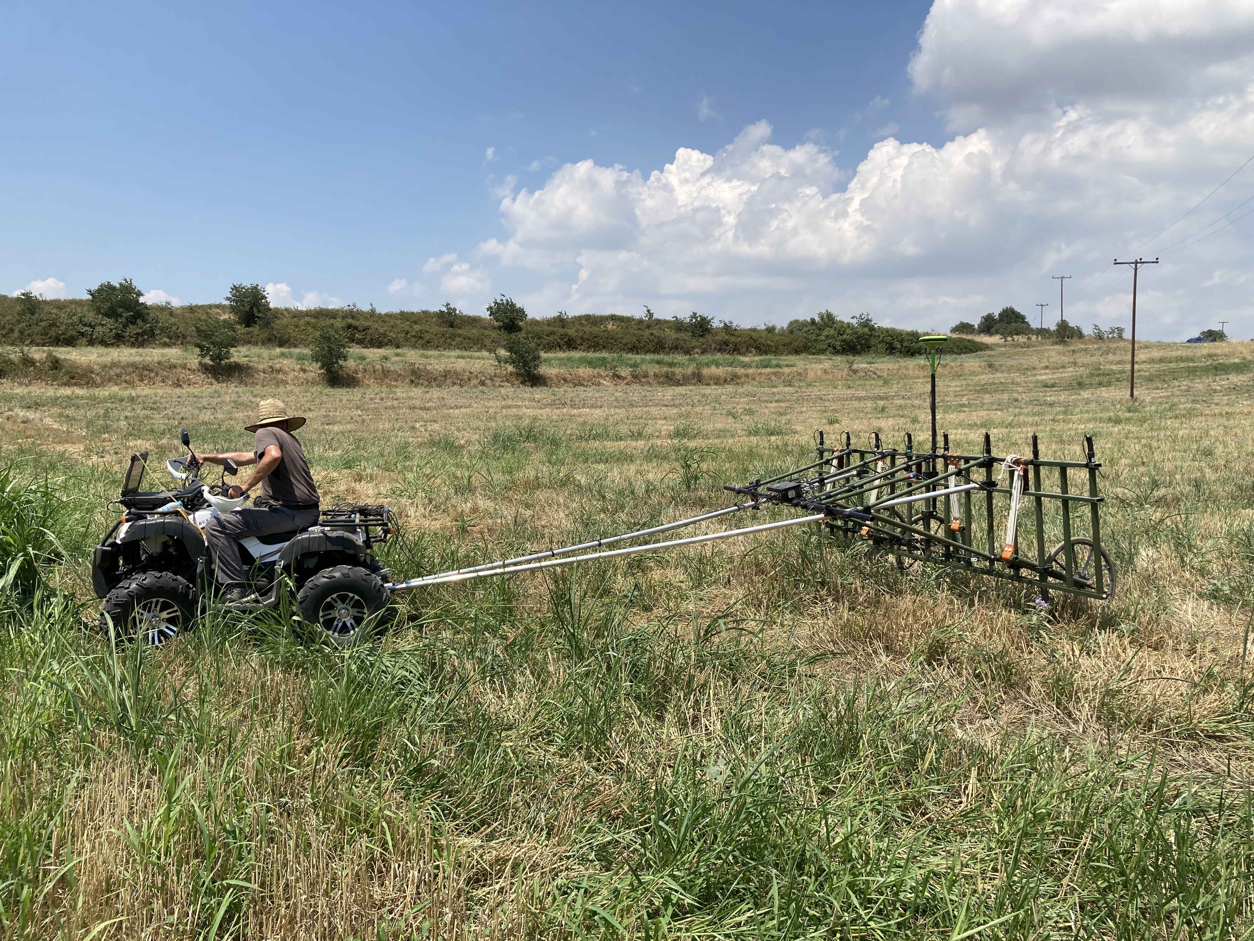
Magnetic prospection is a rapid, non-destructive geophysical method that detects buried archaeological and geological features by measuring local variations in the Earth’s magnetic field. Using single- or multisensor gradiometers, it produces high-resolution, georeferenced maps of anomalies associated with kilns, hearths, walls, pits, ditches, disturbed soils, and metallic objects on land or in shallow-water environments.
Magnetic techniques identify subsurface features by measuring local variations in the Earth’s magnetic field caused by contrasts in the magnetization of rocks, soils and buried materials. Magnetization may be induced by the present geomagnetic field or preserved as remanent magnetization, particularly in iron-rich minerals and materials altered by heating. Archaeological features such as kilns, hearths, disturbed soils, walls, pits, ditches and metallic objects can therefore produce detectable positive or negative magnetic anomalies. Surveys are conducted with proton or caesium magnetometers, or with fluxgate gradiometers that measure the total magnetic-field intensity or its vertical gradients. Data are typically collected at regular intervals along closely spaced transects or grids, producing high-resolution anomaly maps. Multi-sensor systems can improve survey speed and spatial coverage, while accurate positioning with RTK-GNSS ensures reliable mapping. In shallow-water environments, submerged configurations maintain a constant sensor-to-seabed distance and stronger signals, whereas floating systems provide greater mobility but lower sensitivity. Interpretation aims to distinguish archaeological signatures from geological variations, sensor drift, survey noise and modern metallic interference.
Fields of application
Archaeology
Earth sciences
Heritage science (cultural heritage discipline)
Landscape archaeology
Underwater archaeology
Materials
Soil
Other information
-
Output: • Georeferenced plan view maps showing the variation of magnetic properties below the ground and seabed • Diagrammatic interpretation of features related to archaeological structures