
Service: Remote to Close Range Short Wave Infra Red (SWIR) Hyperspectral Imaging
Platforms
Molab
Techniques
Swir hyperspectral imaging (900-2500 nm)
Organization
United Kingdom
Service contact persons
Mapping of original materials, degradation products and conservation materials; Revealing drawings and text; Preliminary identification of materials such as binders, minerals and specific pigments.
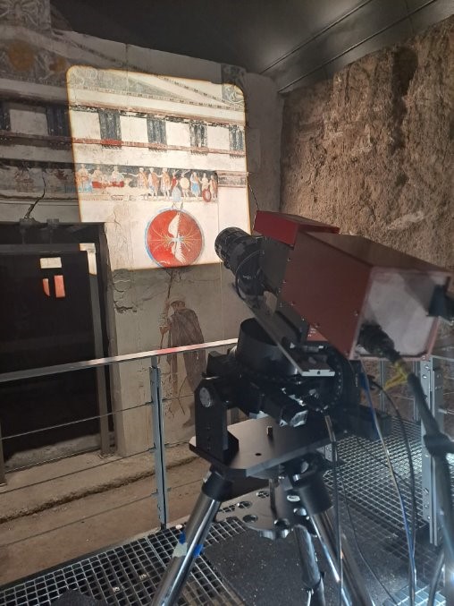
The Short-wave Infrared (SWIR, i.e. ~1000-2500nm) reflectance hyperspectral imaging can operate at both close- and mid-range as well as remote distances (up to tens of metres) at sub-mm spatial resolution and high spectral resolution. In its remote configuration, data collection is feasible from one fixed position on the ground regardless of the height of the monument/object. SWIR spectral imaging can identify or distinguish different organic and synthetic materials (such as binders or adhesive) as well as providing more definitive identification for some inorganic materials (e.g. salts and some specific pigments such as azurite). The longer wavelength of the SWIR range can reduce scattering and thus penetrate more easily through materials that may be opaque under VIS/NIR illumination. Images can be obtained through any of the spectral channels and can reveal features such as faded drawings, writings and preparatory sketches, as well as areas of degradation and past intervention.
It is particularly useful for conservation surveys, and when paired with additional analysis like spectral cluster mapping, can enable material and/or degradation mapping across a surface e.g. salt distribution, hydration mapping of glass and enamels and bronze degradation mapping. The technique provides complementary information for material identification (both original and degraded materials) with VIS/NIR reflectance spectral imaging and remote Raman spectroscopy.
Vibrations can limit the operation of the close-range modality of the SWIR instrument and is therefore not ideal for use on scaffolding. In environments with extreme changes in temperature and humidity over the time of the data collection, systematic control of these environmental parameters is necessary.
Fields of application
Archaeology
Art history
Conservation (discipline)
Conservation science (cultural heritage discipline)
Heritage science (cultural heritage discipline)
Materials science
Philosophy
Materials
Binding media
organic animal parts, binding media, glues, wood, paper, varnishes
Metal
pigments and dyes on any substrate
degradation products
Ceramics
Glass
metallurgical by-products
salt efflorescence
stone
wood
Paper
Textiles
Other information
-
Input: A high-resolution photograph of the object for annotation of collection regions Information on room/space layout and distance to the object/structure Object information- dimensions etc
-
Output: False colour images ( file format negotiable) spectral image cubes ( file format negotiable) ASCII meta data file All data are linked through the MAPSI app including markup of collected regions and comments on the data